Wednesday, December 26, 2018

Anchor Line Retrieval System

    While there are many anchor trolley articles and videos out there, no one seems to have any ideas as to how or where we store the anchor line. I've seen people make some sort of line storage "system" that consists of wrapping it around a piece of PVC pipe, or some sort of hand crank contraption by some well known brand name label. I'm being honest here, but some of these ideas are either really cheap, or really super expensive. And, for some people like myself, I'd want something that compact and easy to make - without adding unnecessary weight.

    So, here's what I use, and it won't cost a whole lot to make.

    Whether I'm fishing saltwater with tidal currents, or freshwater with windy conditions, there are some instances where I just want to stay put in one spot. I currently use a 5 lb. grappling-style anchor and a package of 550 Paracord 50 ft long. But, rather than keep the paracord in my lap, I use a unique retrieval system that I bolted onto the side of my gear crate.


This is my gear crate. After a 2 year absence, I plan to re-install my anchor line retrieval system in the same spot as where the old one was. It seems to work well there. You may want to put your crate on your kayak to see where you want to install it.

Photo Credit #1: Jeff Hall


This is a retractable clothesline unit that I got at Home Depot for about $30. There are two kinds - one is rated at 20 ft long, and this one, which is rated for 40 ft long. I chose the longer 40 ft one because I will be attaching about 50 ft of 550 Paracord to the existing line. The paracord is incredibly strong and really doesn't take up a whole lot of space inside the wheel. You won't need the hardware.

Photo Credit #2: Jeff Hall


The reel already comes with vinyl coated line - which takes a lot of room inside the reel. I pulled out 39 ft of cord and wrapped the cord on the cleat to hold it in place. I then held both the vinyl cord and paracord at the same time and just tied a simple knot. I cut the excess cord on both pieces and left about quarter inch from the knot.

Photo Credit #3: Jeff Hall


I lit ends of both cords. When the flame it got near the knot, I blew out the flame and used the flat end of a screwdriver to flatten the ends of the cord. This is crucial to help keep your cord from untying itself. The flattened ends will prevent the cords from slipping through the knot. Trust me, it works really well, and I've never had a problem since.

Photo Credit #4: Jeff Hall


Here's a close up of the flared cord ends. Even if the ends melt together, this is even better as it will make it impossible for the knot to unravel itself.

Photo Credit #5: Jeff Hall


If the plate looks like it's upside down, it is. The reel has its own cleat built in UNDER the reel. For my tastes, I prefer to have the cleat on the TOP. I used 4 stainless steel screws and 4 stainless steel locking nuts.

Photo Credit #6: Jeff Hall


 To keep the reel firmly in one place, I used a piece of scrap aluminum plate from an old road sign. The road sign was purchased at a local flea market for $10. I started with two bolts in the existing bracket on the reel and secured them in place. Then, I drilled from the inside of the crate on the other two holes that were used on my last crate and secured those other two bolts.

Photo Credit #7: Jeff Hall


      I stopped at a local ACE Hardware/True Value store and found this brass clip. Brass is extremely durable and great for saltwater use. *Pro Tip - Can't find a brass clip at your local hardware store, a marina shop might have something similar, or anyplace that services sailboats.
Just be sure to keep the clip sprayed with WD-40 so the spring & clasp doesn't get corroded.

     *NOTE: Depending on your anchor choice, you may want to bring your anchor with you when choosing the right clasp. The clasp should be able to move freely when attached to the anchor.

Photo Credit #8: Jeff Hall


My friend Mo shows how the anchor line retrieval system is used in conjunction with a anchor trolley. On her crate, the reel is near the front of her crate. This is due to the fact that she has a shorter arm reach than I do. I have longer arms, so I chose to put my reel near the back of the crate.

Photo Credit #9: Jeff Hall


You don't have to use the cleat on the top of the reel housing if you already have a cleat on your kayak. This works out great for her. When you're done with the anchor, you pull it up, disconnect it from the line, and the spring inside the reel automatically retracts the line for you.

Photo Credit #10: Jeff Hall


So, there you have it. My "not-so-secret" anchor line retrieval system that I've been using for about 5 years now. When I rolled a few years ago in the saltwater, the salt damaged the reel spring inside. I bought another 40 ft clothesline reel and repeated the same process as above. A small price to pay for an inexpensive system that works well. It has saved my hide a few times from getting caught up in strong currents going out a breachway. The line is super strong and extremely durable and holds up well. You shouldn't have any problems in freshwater either.

Until then, keep those lines wet & tight! - J

Monday, November 26, 2018

Mono Pond - Columbia,CT


 Photo Credit #1: CT DEEP


    This is my 3rd installment of eastern Connecticut's freshwater lakes & ponds series with Mono Pond State Park Reserve - a small pond located off State Route 66, on 120 Hunt Road, Columbia, CT.

    This little gem of a pond was once covered with milfoil. I had spoke with a local resident a few years ago about the possibility of this pond being a potential candidate for trophy bass management. He said, "The state of CT's DEEP stepped in and used an experimental treatment to rid the invasive weed from the waters. Unfortunately, without proper testing of the treatment, it killed the milfoil, but it also killed off a lot of fish in the process."


At 120 Hunt Road in Columbia,CT, the road going in is paved, as is the rest of the parking area, with a cement ramp for small boats.

Photo Credit #2: CT DEEP 


    After 5 years or so, the milfoil has been eradicated from the waters, the fish have made a comeback, and the bass were huge! I had paddled out to the opposite end of the pond one afternoon and saw some pretty big bass lurking under the lily pads in numerous spots.

 Photo Credit #3: CT DEEP


The parking area at Mono Pond is very small and fills up quickly in the early Spring with only 6 spaces. I've been down here a few times and it's absolutely crazy with cars parked on both sides of the road on opening day! Those that don't have boats will stand on the mound of grass near the dam's deep end.

Photo Credit #4: CT DEEP


The ramp is made from cement and has a low grade angle so 2wd cars & trucks shouldn't have any problems getting their trailers out of the water. 

Photo Credit #5: CT DEEP


The angle of the ramp is easy for cars & trucks to haul their boat trailers out of the water. 
*Note: Shown in the Fall when the state draws down the water at the end of the season.
  
Photo Credit #6: CT DEEP


A map of Mono Pond. 
 
Photo Credit #7: NortheastBass.com


A kayak angler stalks fish in a dense area of lily pads.

Photo Credit #8: CTFishTalk.com

    I have started to replenish my freshwater boxes with top water frogs and some new experimental plastic baits that literally "float" horizontally. Not really sure how the company pulled that off, but they did! They're locally made in Glastonbury,CT and the company is "Area 51 Fishing".
    You can see their Pilot Fish baits in action here on YouTube: Area 51 Fishing's Pilot Fish 

    Looking forward to next year in 2019 to try out these new baits and see how well they work. I've paddled out to the other end of the pond and saw several large bass amongst the lily pads. The pond itself isn't very big, but it does however, hold some truly big bass - which is good for us kayak anglers because we're able to get away from the large crowds, and bigger boats and get at all the hard to reach trophy fish.
    The pond itself isn't very deep - 3.5' feet at 80% of the lake, 6' feet near the boat ramp, and 9' feet near the dam. 

    The photo above shows you the dense area of lily pads that cause some grief with the bigger boats and their trolling motors. Where the kayaks will shine, is their ability to glide over these often overlooked, and hard to reach places to get at your next prized catch!


    As usual, keep those lines wet & tight!  - J


Friday, October 26, 2018

Hopeville Pond State Park - Griswold,CT

    This is the 2nd installment in my continuing efforts to explore the eastern side of Connecticut a little more. I will be getting my fishing license for Connecticut freshwaters next year.


    I grew up in north central CT in a small farm town called Windsor Locks, and fished the local Connecticut River, Farmington River, and Rainbow Reservoir. In the early 1990s, I lost my job and was out of work for nearly two years. In that stretch of time, when I wasn't filling out resumes for local jobs (about 10-20 a day), I killed time by fishing western CT at some of the larger reservoirs like Colebrook Res. & West Branch Res. (aka Hogback Res., which sits behind Colebrook), as well as the Farmington River.


Photo Credit: FourSquare.com


    Fast forward to the present, earlier this Fall, I was asked if I had been to Hopeville Pond State Park, 874 Hopeville Rd, Griswold, Connecticut. I've been there to hike around the park, walk the trails, ride my bike, and check out the boat launch area - which is heavily used by the big bass boat guys.  They have to park their trucks over behind the park ranger's office several yards away from the launch area. We, as kayak anglers, have the awesome option of launching from the beach area because the parking area is right there.
    I had stopped by the local park ranger's office and asked if it was okay to launch from the beach area with my kayak. Of course, he said, "yes", provided we stay away from the people on the beach.

    The park's recreational activities include biking, hiking, camping, fishing, boating, and swimming. The park's campground features 80 campsites. Fish found in 137 acre Hopeville Pond include channel catfish, northern pike, largemouth bass, chain pickerel, and yellow perch.


The picnic area at Hopeville State Park. To the right, is the beach area.

Photo Credit: RVpoints.com


Photo Credit: Pinterest


    My initial views of the water's clarity was pretty clear. The pond is visited by migrating ducks and some Canadian geese. It was a hot spot for paddle boarders, casual paddlers, and the larger bass boat owners as well. There were a few spots where lily pads were present - a good hiding place for bass in the summer. I saw a few of the bass boat guys working the outer edges of the pad areas. No problem for those of us that fish out of kayaks!


Photo Credit: CTFishTalk.com


Photo Credit: CT DEEP CT.gov


Photo Credit: Inland Fishing in CT. CTvisit.com


The boat launch ramp at Hopeville State Park isn't very wide, so it's one vehicle at a time. Trucks with trailers must be parked in the lot behind the Park Ranger's quarters.

Photo Credit: CT DEEP


The boat launch ramp at Hopeville State Park flanks a wooden walking bridge that connects trails on the other side of the park.

Photo Credit: CT DEEP


A large spacious beach area for plenty of swimmers. Kayak Anglers can launch from the beach area - just be careful not to disturb the beach goers.

Photo Credit: SeeSwim.com


The beach area at Hopeville State Park during the Fall. 


Photo Credit: CT DEEP


Sunset twilight over Hopeville State Park & Campground during the Fall. 


A camp fire feels good at the end of a perfect day of fishing at Hopeville State Park & Campground.


So, if you're looking for a perfect blend of hiking, trail biking, camping, paddling, and kayak fishing, give Hopeville State Park & Campground a try. Located in Griswold,CT.

As usual, keep those lines wet and tight! - J


Saturday, September 22, 2018

Bluff Point State Park - Groton, Connecticut

    A lot of the places I've mentioned in the past were in Rhode Island. But, now I'm going to tell you about some places here in Connecticut that are also good for fishing. One such place that comes to mind is Bluff Point State Park in Groton,CT, which sits on the Poquonock River and empties into Long Island Sound. There are NO parking fees for this state park.


Photo Credit #1  - Jeff Hall


Photo Credit #2  - Jeff Hall

Swimming is allowed here. If you don't fish, you can just enjoy a nice quiet paddle experience with no noisy boats or jet skis to harass you.


    * Directions: 

    Coming from I-95 North:  Take exit 88.  Turn right onto SR 117 South.  Turn right at the end onto Route 1 South.  Take a left at the first light onto Depot Road.  Park entrance is at the end of the road.
 
    Coming from I-95 South:  Take exit 88.  Turn left onto SR 117 South.  Turn right at the end onto Route 1 South.  Take a left at the first light onto Depot Road.  Park entrance is at the end of the road.

    
    According to Connecticut's State Parks page, there is a "boat launch area" to put your kayak, or kayaks in. The beauty of this particular spot makes it a real gem for quick & easy access to the saltwater because there's no deep sand to drag your kayak through, or steep ramps to lug your kayak up at low tide. And, anyone who's familiar with this launch spot will tell you, you need to get here early for a decent place to park, because it is well known to the locals in the area.


Photo Credit #3 - Jeff Hall

This photo was taken in late September of 2017. As you can see, the area designated for boat launch access, fills up in a hurry with people parking 2 rows of vehicles in the center of the parking area, as well as the outer edges.


Photo Credit #4 - Jeff Hall

You can see the breaks along the water's edge where you can put in. If it's low tide, I would suggest that you NOT park past the grassy edge line, because the water from high tide comes right up to the edge.

    This state park also features trails for hiking & mountain biking, as well as saltwater fishing from shore, kayak, or boat. Shell Fishing* is allowed here too. 
    
    * Note: A permit is required for shell fishing. Permits are issued by the Town of Groton. Groton Town Offices are located on the corner of Route 1 and Depot Road.
Telephone: (860) 441-6600. 


    Fishing can done all along the shore or from your boat or kayak. There was a bridge at one point linking Bluff Point Parking Area to the Groton Airport, but the bridge has long since been removed. I have seen some people fishing near the break on the rocky outcropping. There is a short footpath to get there - which is where I took the photos 3 & 4 to show you the views of the parking area.


Photo Credit #5 - Jeff Hall

This info board was taken near the Bluff Point area. Each number on the map tells of the area and some of the former historical sites on the sprawling 800+ acre preserve.


Photo Credit #6 - Jeff Hall

The close-up photo above was taken at an info board showing you the hiking/mountain biking trails. It even shows you the break in the land between the park and the Groton Airport (to the right of the park).

Below are some other photos of Long Island Sound that I took while at Bluff Point itself.


Photo Credit #7 - Jeff Hall

Some men fishing off of the large boulders at the end of Bluff Point at low tide. This area is a known hot spot for Striped Bass, Tautog, Flounder, and Bluefish. The darker areas on the boulders show the water mark of high tide, giving these guys a chance to catch something within that narrow window of opportunity.


Photo Credit #8 - Jeff Hall

While this photo may seem scenic, the island is actually owned by Dean Kamen, the owner of Segway personal transportation vehicles. I took this photo from a mile away from Bluff Point's lookout area using a small monocular scope. 
For a really good laugh about this island, go here:
https://en.wikipedia.org/wiki/North_Dumpling_Island


Photo Credit #9 - Jeff Hall

A green tower sits atop a small rocky structure known as Seaflower Reef. In the background is Fisher's Island,NY.


    As usual, keep those lines wet & tight! - J


Friday, August 31, 2018

Camp Cronin Fishing Area - Narragansett, Rhode Island

    During the salt show every Spring, I get questions about "Where's your favorite fishing area and/or spot?", and one of my responses is, "...the Camp Cronin Fishing Area located in Narragansett, RI.".

    When I was a kid, my Dad used to take me fishing in Rhode Island a lot, usually in Westerly,RI next to an old lighthouse that was manned by the Coast Guard. But in recent years, the Coast Guard made the lighthouse unmanned, and sold the property to a private owner - who then cut off access to the point (a locally known hot spot for striped bass and bluefish). I heard rumors that the owner didn't want anybody out there carving up their catch, and leaving the remains everywhere for seagulls to eat & crap everywhere.

    When I tried to find out more information about "Camp Cronin" itself, to give you, the reader some type of background on this hot spot, I came to many "dead ends". There is literally no information containing the words "Camp Cronin", whether it was a former military encampment, installation, base, etc.. So, I did some research on past military forts of World War II, and I came across this web page on NorthAmericanForts.com , about "Fort Nathaniel Greene (2) aka Battery 211".

This is what I found out:

Fort Nathaniel Greene (2)* 
(The Point Judith Fishermen's Memorial)
(1934 - 1948/present), Point Judith
Originally named Point Judith Reservation until 1941. Fort Greene is divided into three separate sections. The East Reservation has Battery Hamilton / 108 (1943 - 1948). The RI National Guard still uses this parcel as a training area.

The West Reservation has Battery 109 (1944). The present is named "The Fishermen's Memorial State Park" which uses this parcel as a campground, as well as most of the former southern parcel. The park office incorporates a former battery command - fire-control tower/silo (Photo 1). The South Reservation* has Battery 211* (1945 - 1948) at the water's edge, and an unnamed four-gun 155mm battery on Panama mounts - two are mostly buried under the beach, the other two were washed away from Hurricane Sandy. "The Point Judith Fishermen's Memorial" is located at Battery 211* (which is buried under the Fishermen's Memorial itself). Three fire-control stations were once located near here at the present Camp Cronin Recreation Area, disguised to resemble typical New England style beach houses. One still remains.
(Not to be confused with Fort Greene (1) in Newport)


Fort Greene Fire Watch Tower


Fort Greene Fire Watch Tower is now part of the Main Office for the "Fisherman's Memorial State Park"


Fort Greene Fire Control Building - the building is in an advanced state of decay, and the property is currently owned by the city of Providence,RI.

To learn more about Fort Greene [2], click the link.

Photo #'s 1, 2, & 3 Credits: John Stanton & Bill Thayer


Photo #4 Credit: Chris Zeeman


Photo #5 Credit: Chris Zeeman

For more info, Click here: Battery 109


    *Author's Note: I made some changes to this article here to clear up some confusion. "The Point Judith Fishermen's Memorial" is located here, and is NOT to be confused with the "The Fishermen's Memorial State Park", which is now a campground for RVs & Motorhomes located a few miles away. Click the link for a dark secret about RI's participation in World War II!

    Anyway, I've always enjoyed searching for new places to launch my kayak, and get out on the open water. And, this place doesn't disappoint! I will extend some caution though, I would classify this particular spot as an "advanced/experienced-only" launch spot. Most people wouldn't venture out past the break on the East wall. I would leave that up to the more advanced kayak anglers in our group. Trust me, you REALLY have to keep your eye on the tidal currents by the Red Buoy Marker on your left coming out of the East wall! Between the currents coming at you from the East, South, and North (out of the Harbor of Refuge) and the big sport fishing boats leaving Point Judith Harbor, you will have your hands full as you try to navigate your kayak to your favorite hunting grounds East of Point Judith Lighthouse.


Camp Cronin in it's earlier years. In this photo, the Pt. Judith Fisherman's Memorial didn't exist.

Photo #6 Credit: KayakAccess.info


Photo #7 Credit: YankeeMagazine.com


Visitors walk along the top of the East wall at sunset.

Photo #8 Credit: HiveMiner.com


The sun sets behind the info board at the Camp Cronin Fishing Area.

Photo #9 Credit: NewEngland.com


Photo #10 Credit: NewEngland.com


Beachgoers take in the midday sunshine behind the East wall at the Point Judith Back Beach at Camp Cronin. This stretch of deep sand will require your kayak's cart be equipped with beach tires (aka balloon tires). It will make your trek across the sand a lot easier.

Photo #11 Credit: HiveMiner.com


A commercial fishing vessel makes its way back to Point Judith Harbor, via cutting through the Harbor of Refuge at high tide, to unload its daily catch. Those of us that choose to fish the East break wall, may have to dress appropriately, for the incoming high tide could cause you to go home soggy. 

Photo #12 Credit: HiveMiner.com


RISAA Kayak Committee members Anthony & Stephanie Caruolo prepping their gear for an afternoon launch. Both Anthony & Stephanie caught several fluke by staying inside the channel next to the green tower at the other break's end.

Photo #13 Credit: Mona Rodriguez


RISAA Kayak Committee members Jeff Hall (left) and Gino DeFeudis (right) discuss their options on where to fish.

Photo #14 Credit: Mona Rodriguez


Jeff & Gino launching (in the slack tide) during the high tide.

Photo #15 Credit: Mona Rodriguez 


Jeff sets up his Hook 5 fishfinder, while Gino checks all the hatches making sure everything is secure.

Photo #16 Credit: Mona Rodriguez


While these photos above were taken in August, on a relatively calm and perfect day, it's hard to believe that anything could wrong. But in 2012, one of the state's most destructive hurricane's, "Hurricane Sandy" (aka Superstorm Sandy) slammed into the Rhode Island coast with such force that it literally decimated the parking area, the fisherman's memorial, and the barrier wall protecting the Harbor of Refuge. The RIDEM (Rhode Island Dept. of Environmental Management) applied for federal grants to aid in rebuilding the parking area, the memorial, and the East wall/coastline.


The waves from the hurricane were so destructive that it picked up large boulders, some as big as a small compact car, and strewn them all over the parking area. Here, local residents survey the damage caused by Hurricane Sandy.

Photo #17 Credit: RIstripedbass.blogspot.com


During the rebuilding process, a drone cam captures the construction crews carefully arranging the large stones into a better built wall, making sure the coastline is better protected from future disasters.

Photo #18 Credit: DredgingToday.com


The Point Judith Fisherman's Memorial now sits next the Overlook, where this photo was taken, and to the left of the parking area. The "overlook" is actually the remains of the Radio Room that was built in 1944. Rather than demolishing it, the state of RI chose to "bury it" under a mound of dirt. The entrances in the front & back of the structure were blocked off with huge stones to prohibit entry into the structure, but a few brave souls managed to wriggle their way in and spray graffiti on the walls.

Photo #19 Credit: FlickrHiveMind.net


Photo #20 Credit: John Stanton


This is the rear entrance of the radio room, which faces the shore, but is blocked off with large boulders to prevent entry into the structure.

Photo #21 Credit: Jeff Hall


Before Hurricane Sandy came, this structure was one of two battery gun emplacements that protected Point Judith from enemy attacks.

Photo #22 Credit: John Stanton


Both this photo, and the one above, were taken before Hurricane Sandy. A combination of rising sea levels and stronger storms, have worked together to erode the large concrete plates around the turret tower base, and wash them out to sea. Slowly erasing Rhode Island's participation in World War II's history.

Photo #23 Credit: Chris Zeeman


This photo was taken recently in January 2017. 

Photo #24 Credit: Jeff Hall


This is the second turret base that sits to the right of the radio room. It sits a little further back than the other base.

Photo #25 Credit: Chris Zeeman


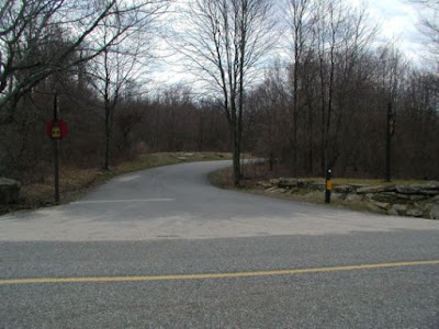
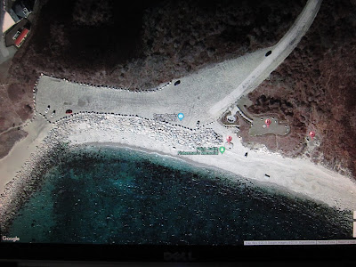
Today, this is the new and improved Camp Cronin Fishing Area parking lot. The two white cars on the far left, is where you would put in the kayaks - provided you have a kayak cart that handle deep sand. The large rocks at this entry point are wide enough to get your kayak through and down to the shoreline on the inside of the East barrier wall.

Photo #26 Credit: Jeff Hall via Google Maps


The stretch of sand that leads down to the protected area to launch is roughly 200 feet long (longer if it's low tide). If you don't have flotation tires, you are going to regret it, as dragging a fully loaded kayak will feel like you're dragging it without tires. There is no way to drive down to launch. It's not a well used launch point, because of the distance & the deep sand involved. When night falls, the action heats up for both surfcasters and kayak fishermen when the fish change direction. This will be a hot spot for years to come as it leads out to the open waters with views of Block Island a short distance away.

Photo #27 Credit: Jeff Hall via Google Maps


As usual, keep those lines wet & tight! - J


*Author's Note: I would like to thank all those involved with the making of this article. Without your photos, this article would've been a lot shorter. Don't forget to click the links and visit the photographer's pages as well.


Photo #28 Credit: Yelp.com


Photo #29 Credit: Elevation.Maplogs.com


Photo #30 Credit: MichaelBlanchette.com